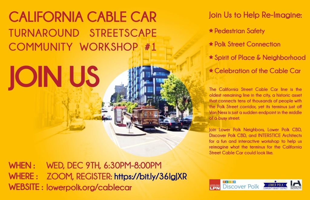
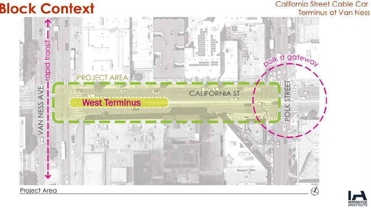
The California Street Cable Car Turnaround Vision Plan is a study to re-imagine the westernmost point of the California line.
- The California Line has operated since since 1878
- Cable Cars have been a National Historic Landmark since 1964
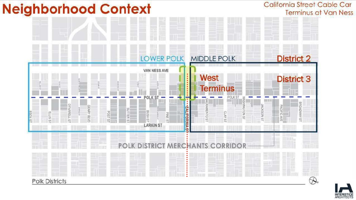
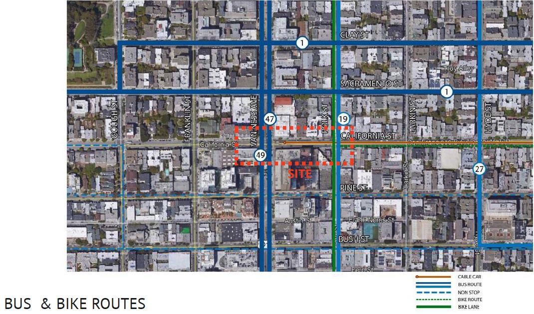
- The California Street Line Connects the Financial District to the Polk Street Merchant Corridor.
- Cable Cars are a significant tourist attraction, with greater than 20,000 riders daily (pre-pandemic).
- The California Street line is used by commuters as well as tourists
IMPROVEMENT & URBAN DESIGN GOALS
- Celebrate the westernmost point of the Historic Cable Car Route
- Create a Gateway to the neighborhood
- Create an urban design concept plan that addresses:
- Rich neighborhood history
- Sustainability and greener streets
- Pedestrian-centered and addresses safety concerns
- Livability & amenities
- Diverse users
- Traffic calming
- Gather & Synthesize community input and ideas to create a beautiful and beloved urban space
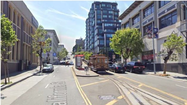
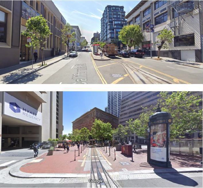
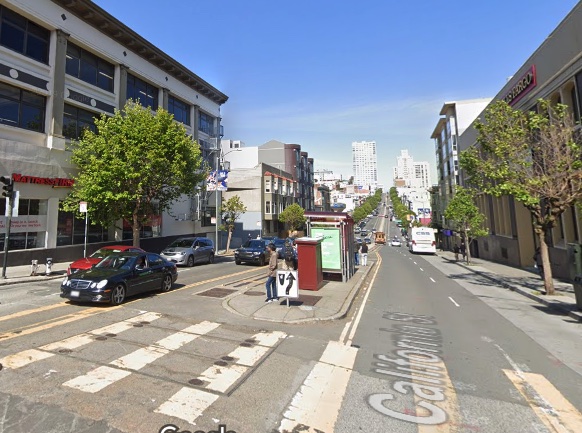
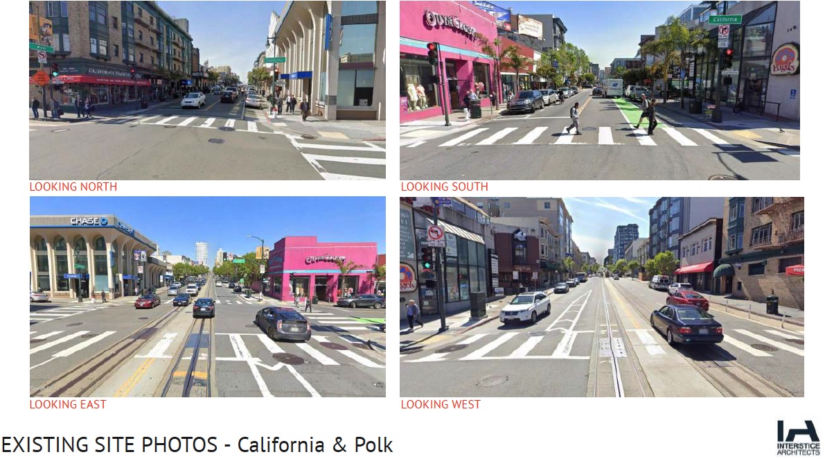
Project Site is Currently Lacking:
- Traffic island with MUNI-style shelter
- Some sidewalk tree planting
- Questionable safety
- Car dominated
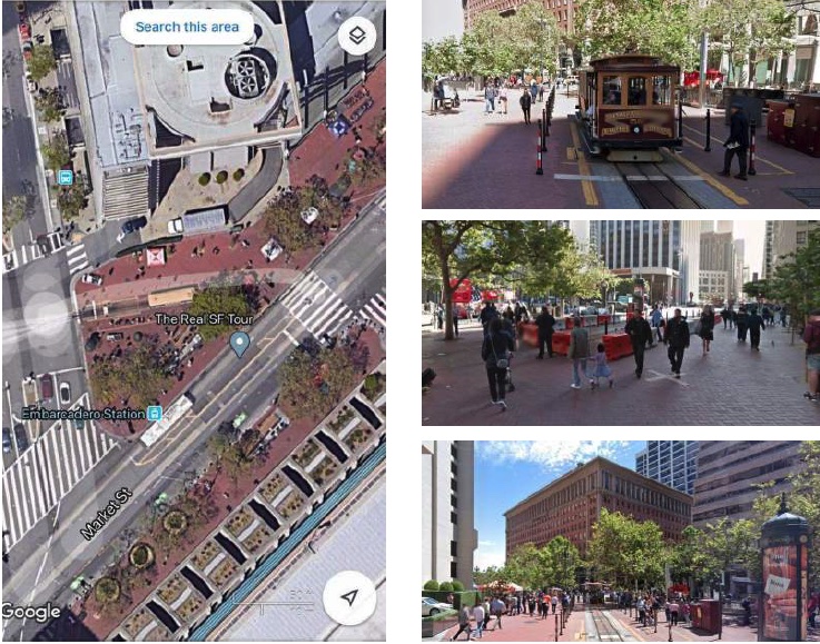
By Comparison East Terminus at Market Street
- Example: Pedestrian Centered Plaza
- Special Paving
- Furnishings/amenities
- Lighting
- Safety Elements
- No Cars
Help Us Re-Imagine:
URBAN DESIGN PRINCIPLES & FEATURES
- Continuous broad sidewalks
- Buffer from traffic
- Safe crossings
- Places to stop and rest
- Commercial uses
- Visual interest
- Uniqueness of place
- Variable street edges
- Pavements
- Signage – scale & coherence
- Street furnishings & amenities
- Shade trees & Green infrastructure
- Lighting
- Art
PRECEDENT: EMBARCADERO STATION
- Pedestrian only
- Special Paving
- Site furnishings:
- Bollards
- News Racks
- Kiosks
- Well-lit
- Tree plantings
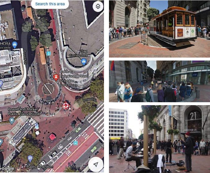
PRECEDENT: POWELL / MARKET TURNAROUND
- Special paving
- Pedestrian only
- Broad & inviting
- Well-lit
- Hanging plantings
- Bollards
- Commercial activity
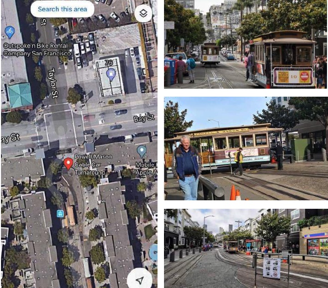
MASON TURNAROUND
- Signage specific to Cable Car
- No cars / Pedestrian only
- Bollards / Informal seating
- Street Trees
- Generous Crossings
- Shelter
- Commercial Frontages
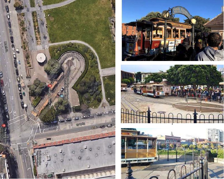
HYDE & BEACH TURNAROUND (HYDE LINE)
- Pedestrian only
- Pedestrian amenities
- Trees at perimeter
- Historical gateway signage
- Differentiation in paving zones
- Nearby seating area
The project is a joint effort between Lower Polk Neighbors, the Lower Polk Community Benefit District, INTERSTICE Architects, and Discover Polk CBD funded by a grant from the Mayor’s Office of Housing and Community Development.
If you have any questions, comments, concerns, or ideas about the proposed parklet, please email [email protected]